How this Fast Diet Lifestyle works: Eat these meals tomorrow, for a calorie total of less than 600. On another day this week, eat the meals from a different post, another day of eating 600 calories or less. Eat sensibly the other days of the week. That’s it: a simple way to lose weight and be healthier. Join me in the Fasting Lifestyle.
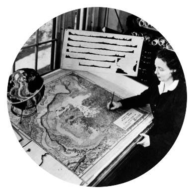
Perseverance and insight were the keys to success for Marie Tharp, explaining how she went from being a simple cartographer to over-turning the entire field of Earth Science in the 1970s. Marie was born on July 30, 1920, in Michigan, but she did not stay there long. Her father was a soil surveyor with the US Department of Agriculture. He moved his family frequently so that he could do field work on the nature and extent of soil bodies. Little Marie would go out into the field with him often, although at the time she was not interested in science. At the University of Ohio, she first studied art, then German [her mother had been a German teacher], and at last she discovered geology. This was not a field open to women at that time, so her professor suggested that she take the course in drafting [drawing geologic maps] to maximize her job opportunities. By then, WWII was on, and the University of Michigan advertised for women to study petroleum geology. Marie applied and received a Master’s Degree. Her first job was in Oklahoma to work for Stanolind Oil. As a woman, Tharp was given desk work and she dealt with boredom by earning a degree in math from University of Tulsa. In 1948, she accepted a job with Lamont Geological Laboratory (now the Lamont-Doherty Earth Observatory at Columbia University) — hired not as a research scientist, but as research assistant to help undergraduate boys with their work. Again, she was bored, so she quit. Quickly rehired, Tharp was assigned to work with Bruce Heezen who was working on a project to lay under-sea cables. To do that, they had to know what the sea floor looked like — and no one knew. Alfred Wegener had put out his theory that the sea floors were flat and that the continents slid around over them, sometimes bumping into each other. These ideas were considered absurd. Using the new technology of radar/sonar soundings, Heezen set out to study the floor of the North Atlantic. He and his crew sailed across the ocean, taking soundings all the way. It would have made sense for his cartographer, Marie, to be on board to work with these data, but women were not allowed as crew on research vessels. When she finally received the data, Tharp used them to draw a profile of the sea floor. It wasn’t flat! In the middle of the ocean was a high mountain range, with a deep valley in the center. Heezen did five more trans-ocean voyages, and Marie’s cross-sections showed the same thing each time. Then Heezen compared the location of this central valley with earthquake data, and found that there was a correlation. What was the connection? When Tharp suggested that the valley was a ‘rift’ in the Earth’s crust, where the crust was moving, Heezen dismissed the idea as ‘girl talk’, worried that such an idea would bring scorn and ridicule. Marie persevered, making a map — based on Heezen’s data and her insights — of the Atlantic Ocean sea floor that showed a 10,000 mile long ridge with a rift valley in the center. When it was presented in 1956 at a conference, it was greeted with surprise and disbelief. Twenty more years of research and cartography ensued, and when in 1977, the most complete map of the sea floor was produced, the long-held ideas were overturned, and the field of “Plate Tectonics” was born. Without Marie Tharp’s maps we would not have a fuller understanding of how the crust’s plates move, or how such motion causes mountain ranges. Also, I would not have had such interesting topics to teach to my Earth Science students! There have been several major earthquakes lately, and volcanic activity, all located on plate boundaries such as rift valleys or convergences. Rather than thinking that they were random events, we know their cause — even if we cannot predict them or stop them from happening.
Our breakfast is from the Asores, volcanic islands in the middle of the North Atlantic Ocean. Tharp’s map showed that they were located where three plates came together, causing a volcanic hot spot where lava built up the islands. Our dinner features seafood — what better way to honor the maker of the most famous map of the sea floor?
Azorean Queso Egg: 158 calories… 8.5 g fat… 1 g fiber… 10 g protein… 10.4 g carbs… 71 mg Calcium… NB: The food values shown are for the plated foods, not for the optional beverages. PB GF Two of the favorite flavors of the Azores combine for this egg dish, and the pineapple completes the triad.
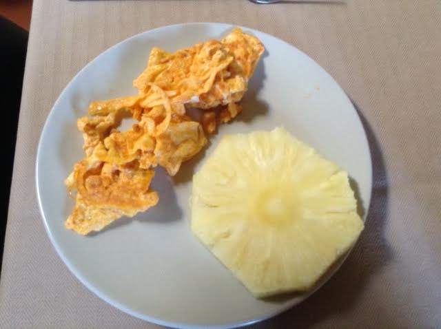
++ 1 two-oz egg ++++ 1.5 tsp Queso Fresco ++++ 1 tsp Chorizo Paste ++++ 1½ tsp Pimenta do Quejio sauce ++++ 2 oz pineapple -OR- ¼ cup blueberries -OR- 1.5 oz banana ++++ Optional: blackish coffee [53 calories] or blackish tea or mocha cafe au lait[65 calories] ++
Cream the cheese, chorizo paste, and Pimenta sauce until smooth. Whisk in the egg, then bake in an oven-proof dish or cook in a saute pan. Slice the fruit and sip some Brazilian coffee for a delicious meal. Pass the Pimenta Sauce!
Haddock w/ Farro & Chickpeas: 252 calories… 3.6 g fat… 7 g fiber… 19 g protein… 38.4 g carbs… 37.5 mg Calcium… PB GF The whole grains and chickpeas help to make a small amount of fish taste like a lot more. Then you add a vegetable of your choice. Good stuff.
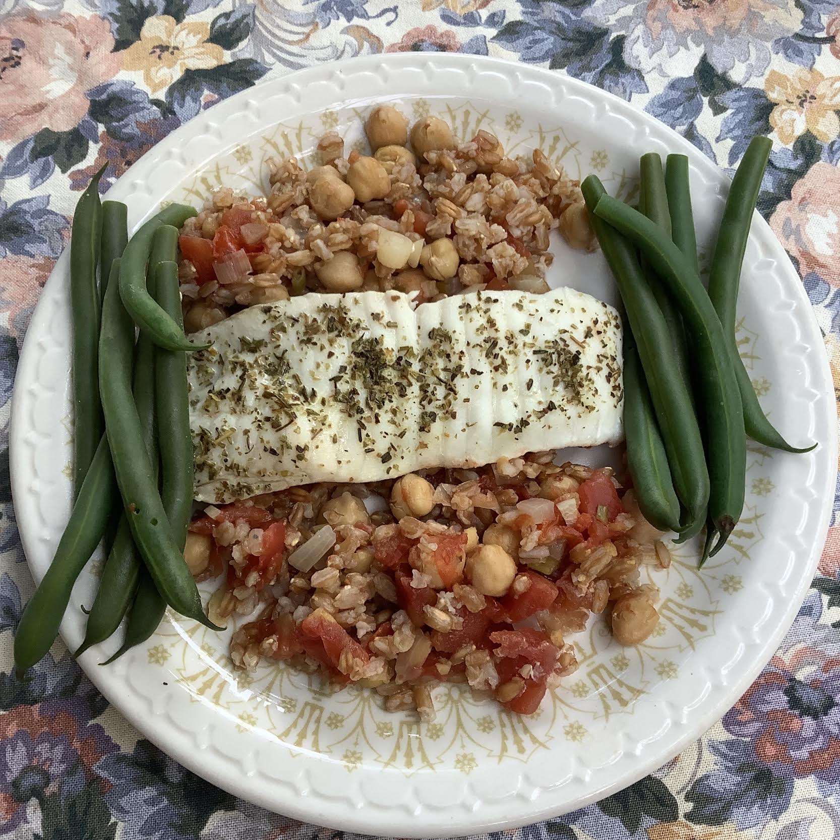
++ ¾ cup chickpea ragout ++++ ½ c cooked farro ++++ 2.5 oz raw haddock ++++ PLUS: 2 oz broccoli OR 2½ oz carrots OR 2½ oz green beans OR 2 oz beets each adds about 20 calories and an average of 2 g fiber to the meal
Cook the farro in one pan and the vegetable in another. Combine the cooked farro with the chickpea ragout and season to taste. If the fish is raw, place on top of farro-ragout in a pan, cover and cook until everything is warm and fish is cooked. If fish is cooked, add to cooked vegetables and heat gently. Plate alongside vegetables.

